
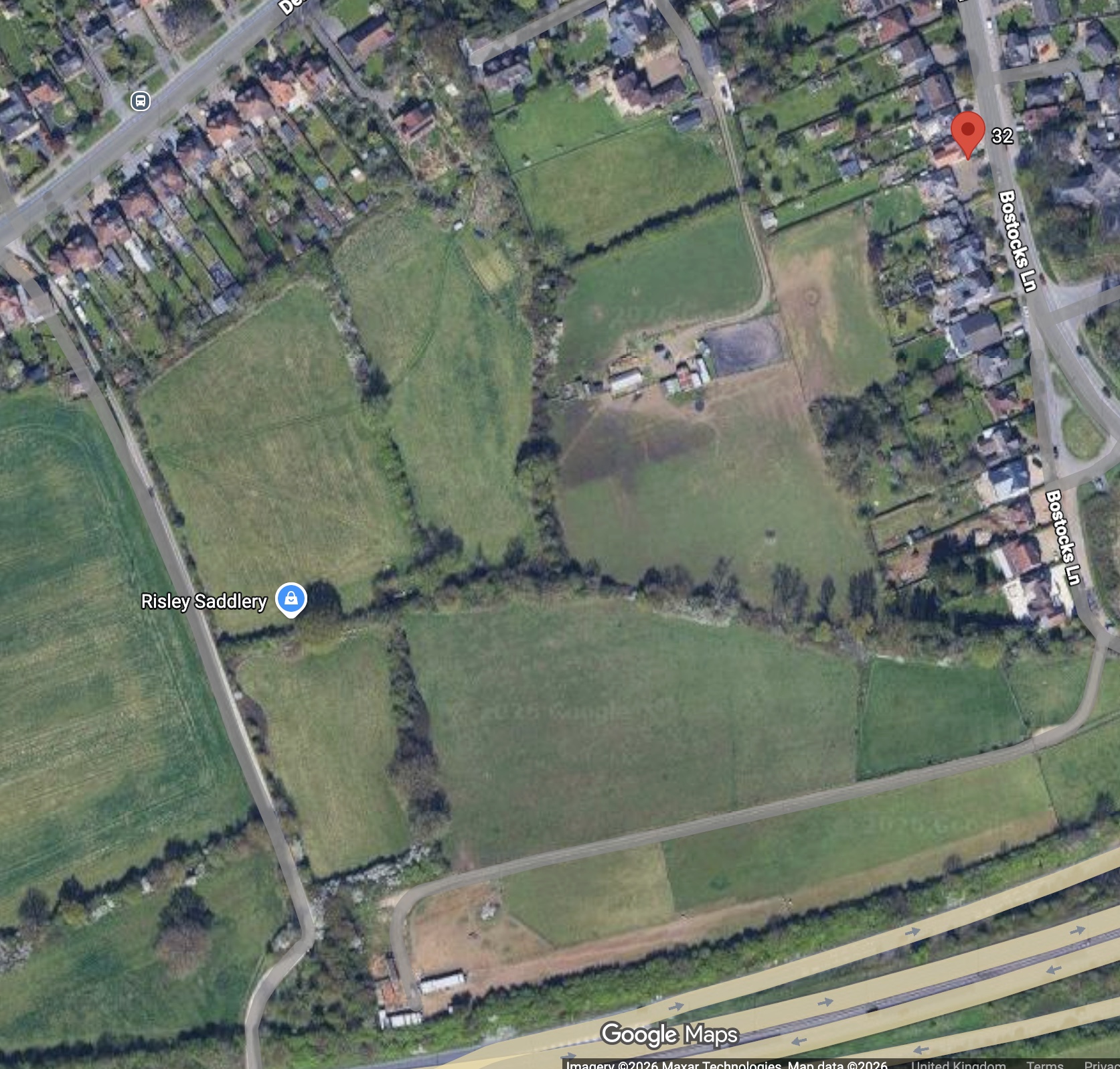
Plans for a major housing development on Green Belt land in Risley have been submitted – with developers arguing that national planning rules now make it difficult for the council to refuse.
The outline application, lodged with Erewash Borough Council, proposes up to 150 homes on a 6.23 hectare site off Bostocks Lane – land currently used as paddock and equestrian fields, sitting between the edge of the village and the A52.
If approved, it would represent a significant expansion of the settlement, with new roads, green spaces and infrastructure, alongside a large proportion of affordable housing.
But beyond the scale of the development itself, it is the reasoning behind it that could prove most controversial.
A planning system under pressure
At the centre of the application is a blunt assessment of the council’s position.
Planning documents state that Erewash has consistently failed to meet government housing targets, delivering only 67% of required homes over the past three years – well below the level expected nationally.
Combined with the withdrawal of the borough’s emerging Local Plan earlier this year, developers argue that the council is now operating without a robust policy framework to resist new housing proposals.
Under national planning rules, that situation triggers what is known as the “presumption in favour of sustainable development” – a policy shift that effectively tilts the balance toward approval unless clear harm can be demonstrated.
In simple terms, the application suggests the council may have limited grounds to say no.
Redefining the Green Belt
The site itself sits within the Nottingham–Derby Green Belt, an area traditionally protected from development to prevent urban sprawl.
However, the application leans heavily on recent changes to national policy, which introduce the concept of “grey belt” – land that, while technically within the Green Belt, is judged to make only a limited contribution to its purpose.
Developers argue that this particular site falls into that category. Positioned between existing housing and major transport infrastructure, they claim it does not play a meaningful role in preventing towns merging or protecting the wider countryside.
On that basis, they conclude the land should no longer be treated as strongly protected – and should instead be considered suitable for housing.
It is a reinterpretation of Green Belt policy that is likely to attract close scrutiny.
Traffic, travel and the reality on the ground
As with many developments of this scale, the impact on local roads is likely to be a central concern.
Transport assessments submitted with the application estimate that the scheme could generate more than 1,000 additional vehicle movements each day, with the majority of journeys expected to be made by car.
Peak hour traffic would increase by around 70 to 76 trips, with most vehicles expected to head toward the M1 junction or nearby local routes.
Access to the site would be created via a new junction on Bostocks Lane – a change that would require the demolition of an existing property to make way.
Despite these changes, the application concludes that the overall impact on the highway network would not be “severe”, a threshold that often determines whether schemes can be refused on transport grounds.
Environmental trade-offs
Environmental considerations form another key part of the application – and again, the conclusions are likely to prompt debate.
Initial assessments show that the development would result in a net loss of biodiversity on the site itself, falling short of the government’s requirement for a 10% net gain.
To address this, developers propose delivering environmental improvements elsewhere, either through off-site habitat creation or contributions to external schemes.
The site currently includes grassland, hedgerows and mature trees, some of which would be removed to accommodate roads and housing. While mitigation and replanting are proposed, the balance between loss and replacement is likely to be closely examined.
Living next to the motorway
The site’s location, bordered by the A52 and close to the M1 interchange, also raises practical questions about living conditions.
A detailed noise assessment acknowledges that mitigation measures — such as barriers or landscaped bunds — would be required to reduce traffic noise to acceptable levels.
Developers say these measures can be designed into the scheme, but their inclusion underlines the realities of building housing in close proximity to major transport corridors.
What happens next
At this stage, the application seeks outline approval only, meaning the exact layout, design and appearance of the development would be decided later if permission is granted.
Erewash Borough Council will now assess the proposal against national policy, local considerations and public feedback before reaching a decision.
But with housing targets unmet, planning rules evolving, and the definition of Green Belt itself under pressure, the decision may come down to a broader question: not just whether this site should be built on – but how much control the council still has over decisions like it.
Members of the public can submit their views on the application directly to Erewash Borough Council. Representations can be sent by email to planning@erewash.gov.uk, quoting application reference number PP-14622643. Comments received within the consultation period (deadline 15 May 2026) will be taken into account as part of the council’s decision-making process.
A public meeting has now been arranged in response to the plans, as residents begin to organise their response. The meeting will take place at Risley Village Hall at 7:00pm on 7 May, with local people invited to attend, share views and discuss next steps.
One Comment
This is a ridiculous proposal. Sandiacre is regularly blocked with traffic because vehicles cannot get on to the motorway/A52 with traffic trailing back down to Sandiacre centre and up Rushy lane and beyond the village boundary. Meeting the housing requirement does not mean build at any cost.