
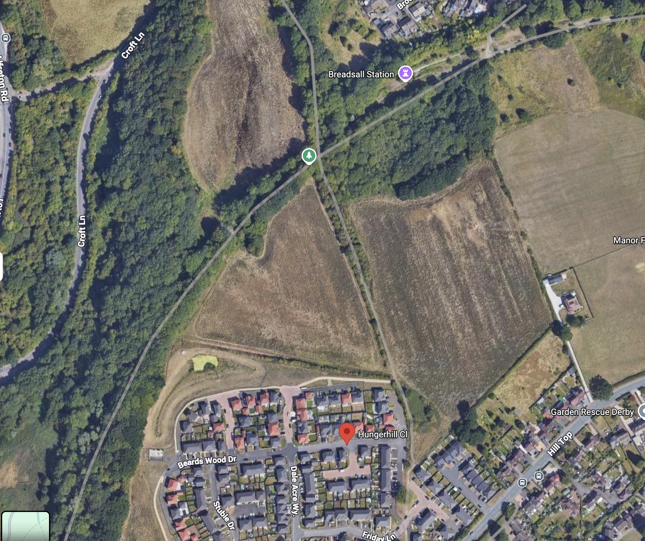
Plans for a major housing development that could bring up to 160 new homes to land off Hungerhill Close have been submitted to Erewash Borough Council.
The outline planning application, lodged by Wheeldon Brothers, proposes creating a new neighbourhood on agricultural land between the existing Oakwood estate and the Great Northern Greenway.
If approved, the development would include up to 160 homes, with 72 classed as affordable housing, along with a children’s play area, new landscaped open space, a large drainage pond and new walking and cycling links.
Although the application has now been submitted, planning permission has not yet been granted. Erewash Borough Council will consider the proposals, seek comments from residents and consultees before deciding whether the scheme should go ahead.
Access through Hungerhill Close
Traffic is likely to be one of the biggest talking points as the application is considered.
According to documents submitted with the application, vehicles would access the development via an extension of Hungerhill Close before joining the wider road network through Dale Acre Way and the A608. The developer says detailed traffic modelling has been carried out to assess the impact on nearby junctions.
The plans also include new pedestrian and cycle links, with connections to the Great Northern Greenway and existing public footpaths.
What would be built?
Because this is an outline planning application, the council is being asked to decide whether housing should be built on the site in principle, rather than approve the detailed design of every home.
However, the submitted masterplan gives an indication of how the site could be laid out, including areas of open space, retained woodland, a children’s play area and a large attenuation pond designed to manage surface water. The masterplan also shows where roads, open space and landscaping could be located, although these details may change if the development progresses.
The final appearance, layout and landscaping would be decided through later applications if outline permission is approved.
Flooding and wildlife
Flooding is also likely to be one of the issues residents look at closely during the consultation.
The developer’s Flood Risk Assessment concludes the site lies within Flood Zone 1, the lowest category of flood risk, and proposes sustainable drainage measures, including an attenuation pond, to control surface water run-off.
The application is also supported by ecology, landscape and biodiversity reports, which propose retaining existing woodland where possible, creating new planting and delivering biodiversity improvements both on and off the site.
Have your say
The application will now be considered by Erewash Borough Council, with residents, statutory bodies and other organisations given the opportunity to comment before a decision is made.
Residents will be able to submit comments to Erewash Borough Council before a decision is made on the application. The application details can be accessed on their website here.
As always, Ilkeston News will report fairly on the application as it progresses, including any significant updates, consultation responses and the council’s eventual decision.